Category:Johann Baptist Homann
Jump to navigation
Jump to search
German geographer and cartographer | |||||
| Upload media | |||||
| Date of birth | 20 March 1664 Kammlach | ||||
|---|---|---|---|---|---|
| Date of death | 1 July 1724 Nuremberg | ||||
| Country of citizenship | |||||
| Occupation | |||||
| Member of | |||||
| Work location | |||||
| |||||
Subcategories
This category has the following 10 subcategories, out of 10 total.
A
- Atlas Silesiae (1750) (24 F)
C
- Cartouches by Homann family (26 F)
H
M
S
- Homann Salzburg 1712 (12 F)
Pages in category "Johann Baptist Homann"
This category contains only the following page.
Media in category "Johann Baptist Homann"
The following 200 files are in this category, out of 290 total.
(previous page) (next page)-
Ganerbschaft of Treffurt.JPG 1,056 × 1,408; 706 KB
-
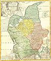
1710 Homann Map of Denmark "Iutiae" - Geographicus - Iutiae-homann-1710.jpg 2,500 × 2,935; 2.42 MB
-
Homann Regni Mexicani seu Novae Hispaniae, Ludovicianae c.1712-1730 UTA.jpg 3,259 × 2,688; 2 MB
-
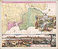
1710s view of Istanbul (cropped).tif 9,189 × 2,332; 20.46 MB
-
County of Stolberg.JPG 1,408 × 1,056; 783 KB
-
The Eichsfeld.JPG 1,056 × 1,408; 803 KB
-
The Vogtei.JPG 1,056 × 1,408; 715 KB
-
Western Thuringia.JPG 2,112 × 2,816; 2.38 MB
-
1716 Homann Map of Burgundy, France - Geographicus - Burgundiae-homan-1716.jpg 4,000 × 4,759; 4.58 MB
-
1716 Homann Map of Ireland - Geographicus - Ireland-homann-1716.jpg 4,000 × 4,763; 6.76 MB
-
1716 Homann Map of New England "Nova Anglia" - Geographicus - NovaAnglia-homann-1716.jpg 3,000 × 2,529; 1.89 MB
-
Schlossparkhildburghausen1720.JPG 864 × 441; 71 KB
-
Homann Amplissimae Regionis Mississipi c. 1720 UTA.jpg 6,000 × 5,321; 16.4 MB
-
1725 Baronie Schauen.jpg 1,443 × 849; 450 KB
-
1728 Homann Map of Bavaria, Germany - Geographicus - Bavariae-homann-1728.jpg 4,301 × 5,000; 8.6 MB
-
1730 Homann Map of Spain and Portugal - Geographicus - Hispania-homann-1730.jpg 5,000 × 4,212; 7.63 MB
-
1752 atlas - Atlas compendiarius quinquaginta tabularum geographicarum Homannianarum.djvu 10,113 × 16,674, 40 pages; 133.3 MB
-
Tractus Eichsfeldiae.jpg 5,873 × 4,870; 2.07 MB
-
18th century map Imperii Persici.jpg 11,284 × 8,819; 18.04 MB
-
Aegyptus Hodierna, Map of Egypt MET L.2009.33.13.jpg 1,736 × 1,940; 3.2 MB
-
Agri Parisiensis tabula particularis, qua maxima pars insulae Franciae... by Johann Homann.jpg 5,880 × 6,944; 26.56 MB
-
Altstadt Erlangen mit Veste Homann 001.jpg 644 × 356; 99 KB
-
Atlas Coelestis.jpg 2,600 × 2,213; 2.32 MB
-
Atlas Germaniae - Holstein.png 5,071 × 4,224; 35.66 MB
-
Balkanhalbinsel BV014334758.jpg 10,528 × 8,666; 11.65 MB
-
Berchtesgaden, c. 1715.jpg 1,491 × 2,071; 1.19 MB
-
Bremen Old Map 5.jpg 978 × 833; 201 KB
-
Ca. 1700 allegorical map of Cockaigne.jpg 14,302 × 12,457; 39.09 MB
-
Ca. 1706 map of Europe during the Solar eclipse of May 12, 1706.jpg 14,154 × 12,392; 42.8 MB
-
Carte Alsatia inferior.jpg 5,062 × 6,698; 10.89 MB
-
Carte Alsatia superior.jpg 5,017 × 6,727; 11.17 MB
-
Carte de l'isle de la Martinique Detail 1.jpg 918 × 650; 136 KB
-
Carte de l'isle de la Martinique Detail 2.jpg 940 × 650; 182 KB
-
Carte de l'isle de la Martinique Detail 3.jpg 979 × 650; 201 KB
-
Carte de l'isle de la Martinique.jpg 753 × 650; 128 KB
-
Circulus Sueviae Homann after1729.jpg 4,388 × 3,886; 3.46 MB
-
Circulus Sueviae Homann.jpg 940 × 835; 485 KB
-
Comitatûs Burgundiae.jpg 6,688 × 7,667; 17.69 MB
-
Different Views of the Major Cities in Persia WDL11740.png 1,600 × 1,358; 4.43 MB
-
Dominii Veneti cum vicinis Parmae, Mutinae, Mantuae et Mirandolae Statibus Nova Descriptio.jpg 7,649 × 6,531; 19.69 MB
-
Ducatus Mediolani una cum Confinÿs accurata Tabula.jpg 7,728 × 6,567; 19.36 MB
-
Ducatus Stiria Novissima Tabula 1725.jpg 7,677 × 6,172; 39.52 MB
-
Ducatus Stiriae novissima tabula - CBT 5878215.jpg 5,623 × 4,749; 8.66 MB
-
Ducatus Stiriae Novissima tabula 1720.jpg 3,747 × 3,202; 2.39 MB
-
Eigentliche Verzeichnung der Gegend und - Homann Johann btv1b5904162b.JPEG 1,336 × 1,054; 574 KB
-
Elbinseln Joh Bapt Homann 1705.jpg 5,337 × 2,571; 4.12 MB
-
Ephemerides motuum coelestium geometricae - CBT 5870664.jpg 5,532 × 4,634; 7.09 MB
-
Erivan die Haupt-Stadt in Armenia.jpg 1,724 × 1,315; 352 KB
-
Erlangen Altstadt 1721 001.JPG 800 × 703; 241 KB
-
Erlangen Hohmann Schloss und Schlossgarten Plan 1721 001.jpg 1,000 × 844; 293 KB
-
Erlangen Hohmann Stadtplan 1721 001.jpg 1,000 × 847; 349 KB
-
Erlangen Hohmann-Plan Ausschnitt 001.jpg 658 × 417; 125 KB
-
Erlangen Hugenottenkirche 1721 001.JPG 800 × 711; 232 KB
-
Erlangen Hugenottenplatz 1721 001.JPG 800 × 719; 225 KB
-
Erlangen Langes Haus Redoutensaal Markgrafentheater 1721 001.JPG 800 × 717; 238 KB
-
Erlangen Markgrafentheater 1721 001.JPG 800 × 689; 271 KB
-
Erlangen Redoutensaal 1721 001.JPG 800 × 691; 278 KB
-
Westend, Frankfurter Gemarkung.png 1,000 × 823; 1.97 MB
-
Frankfurt, circa 1730.jpg 774 × 662; 201 KB
-
1744 Delisle-Homann.jpg 1,943 × 2,489; 2.82 MB
-
Generalis Totius Imperii Moscovitici Novissima Tabula.jpg 7,515 × 6,482; 17.72 MB
-
Geographica descriptio montani cujusdam districtus in Franconia - CBT 5876492.jpg 5,497 × 4,669; 7.01 MB
-
Geographische Universal - Zeig und Schlag - Uhr.jpg 942 × 768; 322 KB
-
German divided in its 10 circles.jpg 1,316 × 1,156; 749 KB
-
Gladbacum.jpg 554 × 459; 59 KB
-
Pincerno - Hamburg 1700.jpg 991 × 829; 172 KB
-
Hohmann.jpg 2,000 × 2,256; 1.98 MB
-
Homann - Marocca - 1726.jpg 640 × 558; 121 KB
-
Homann - Planiglobii Terrestris Cumutroq Hemisphaerio Caelesti.png 1,620 × 1,400; 4.8 MB
-
Homann Imperium Turcium.jpg 768 × 665; 426 KB
-
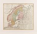
Homann Scandinavia.jpg 3,000 × 2,780; 3.32 MB
-
Homann Schlaraffenland.jpg 400 × 246; 43 KB
-
Johann Baptist Homann AGE V08 1801.jpg 694 × 854; 121 KB
-
Homann, Johann Baptist (1664-1725).jpg 1,678 × 2,321; 3.32 MB
-
Homann, Johann Baptist — Sphærarum artificialium typica repræsentatio — c. 1720.jpg 1,200 × 1,030; 481 KB
-
Homann-1722.jpg 650 × 218; 84 KB
-
Hydrographia Germaniae - CBT 5873266.jpg 5,807 × 4,773; 7.5 MB
-
Illustrasjon til Atlas novus, fra ukjent årstall.png 2,747 × 4,534; 30.13 MB
-
Imperium Turcicum in Europa, Asia et Africa Regiones Propias, Tributaias Clientelares.jpg 11,372 × 8,819; 17.5 MB
-
Imperium Turcicum in Europa, Asia Et Africa.jpg 7,092 × 6,057; 16.29 MB
-
Insula Creta hodie Candia in sua IV territoria divisa cum adjacentibus... - CBT 5883908.jpg 5,601 × 4,738; 7.74 MB
-
Insula Creta hodie Candia in sua IV. territoria divisa ... - btv1b53011439n.jpg 7,016 × 5,948; 7.48 MB
-
J. B. Homann - Danubii cum adiacentibus regnis.jpg 640 × 517; 141 KB
-
Johanne Baptista Homann, 1724.png 591 × 380; 396 KB
-
Jomann Imperium Periscum.jpg 1,992 × 1,700; 2.18 MB
-
Judaea seu Palaestina map by Homann c1741.jpg 2,953 × 2,561; 4.48 MB
-
Karte - Eichstätt und Umgebung in Vogelschau - Homann - um 1730.jpg 1,756 × 1,500; 647 KB
-
Karte der ungefähren Lage des Hochstifts Eichstätt.jpg 1,997 × 1,315; 2.85 MB
-
Karte Frankfurt Land (um 1700).jpg 1,346 × 1,183; 1,004 KB
-
Karte Hochstift Würzburg (edit).jpg 1,927 × 1,667; 1.18 MB
-
Karte Hochstift Würzburg.JPG 2,066 × 1,754; 979 KB
-
Karte Lausitz 1715.png 7,832 × 5,489; 97.48 MB
-
Karte von Deutschland in seinen Grenzen, Ländern und Kreisen, 1741.jpg 3,628 × 3,204; 5.05 MB
-
Kupferstich - Nürnberg - Ansichten auf Sammelblatt - bei Homann - um 1720.jpg 3,572 × 3,068; 4.05 MB
-
Kupferstich - Nürnberg - Beunt - Homann.jpg 1,920 × 1,639; 1.49 MB
-
Landgraviat. Thuringiae.jpg 7,585 × 6,564; 19.82 MB
-
LASB K Hellwig 0030.jpg 7,731 × 6,890; 14.88 MB
-
LASB K Hellwig 0048.jpg 7,587 × 6,444; 7.28 MB
-
LASB K Hellwig 0049.jpg 7,218 × 6,102; 6.73 MB
-
LASB K Hellwig 0050.jpg 7,182 × 6,336; 6.56 MB
-
LASB K Hellwig 0116.jpg 7,425 × 6,399; 16.95 MB
-
LASB K Hellwig 0117.jpg 7,209 × 6,282; 14.29 MB
-
LASB K Hellwig 0118.jpg 7,944 × 6,924; 13.46 MB
-
LASB K Hellwig 0119.jpg 7,227 × 6,396; 16.17 MB
-
LASB K Hellwig 0152.jpg 6,498 × 13,612; 10.64 MB
-
LASB K Hellwig 0183.jpg 6,147 × 7,133; 7.31 MB
-
LASB K Hellwig 0186.jpg 6,264 × 7,368; 13.91 MB
-
LASB K Hellwig 0204.jpg 8,736 × 10,842; 22.27 MB
-
LASB K Hellwig 0206.jpg 8,848 × 10,478; 24.5 MB
-
LASB K Hellwig 0370.jpg 7,440 × 6,432; 15.23 MB
-
Lotharingiae Tabula Generalis 01.jpg 7,306 × 6,366; 18.14 MB
-
Lotharingiae Tabula Generalis 02.jpg 7,798 × 6,604; 19.65 MB
-
Lurconia-Schlaraffenland.jpg 570 × 374; 247 KB
-
Map HOMANNO Ukrania.jpg 3,000 × 2,521; 2.44 MB
-
Map of Imperium Turcicum.JPG 3,072 × 2,304; 1.23 MB
-
Mapa Caribe 1720.jpg 2,820 × 2,332; 4.69 MB
-
Mapa geographica completens Indiae Occidentalis.jpg 3,102 × 3,677; 3.18 MB
-
Marchionatus Moraviae Circuli Znoymensis et Iglaviensis - CBT 5665413.jpg 5,636 × 4,761; 7.44 MB
-
Marchionatus Moraviae Circulus Hradistiensis - CBT 5665369.jpg 5,658 × 4,772; 7.19 MB
-
Milano kartus.jpg 1,487 × 1,223; 549 KB
-
Motus planetarum superiorum - CBT 5870771.jpg 5,682 × 4,738; 6.34 MB
-
Napoli1727 (cropped).jpg 315 × 157; 64 KB
-
Napoli1727.jpg 650 × 556; 191 KB
-
Nova et accurata Carinthiae ducatus tabula geographica - CBT 5878278.jpg 5,566 × 4,668; 8.8 MB
-
Nova et accurata Carinthiae Ducatus Tabula geographica 1716.jpg 3,604 × 3,071; 3.84 MB
-
Nova et accurata territorii Vlmensis - CBT 5877608.jpg 5,658 × 4,760; 8.68 MB
.jpg/230px-Homann%2C_Johann_Baptist_(1664-1725).jpg)



_-_Geographicus_-_Franconiae-homann-1720.jpg/104px-1720_Homann_Map_of_Franconia%2C_Germany_(_Bavaria%2C_Bamberg%2C_Würtzburg%2C_Nuremberg_)_-_Geographicus_-_Franconiae-homann-1720.jpg)

_-_Geographicus_-_PrincipatusTransilvaniae-homann-1716.jpg/120px-1720_Homann_Map_of_Transylvania_(_Romania_)_-_Geographicus_-_PrincipatusTransilvaniae-homann-1716.jpg)


_-_Geographicus_-_CaspianKamchatka-homann-1725.jpg/120px-1725_Homann_Map_of_the_Caspian_Sea_and_Kamchatka_(as_Yedso)_-_Geographicus_-_CaspianKamchatka-homann-1725.jpg)

_-_Geographicus_-_SaxoniaeInferioris-homann-1730.jpg/120px-1730_Homann_Map_of_Lower_Saxond_(_Berlin_Lubeck%2C_Hamburg%2C_Bremen_)_-_Geographicus_-_SaxoniaeInferioris-homann-1730.jpg)


_-_Geographicus_-_AmerEnglish-homann-1740.jpg/120px-1730_Homann_Map_of_the_English_Colonies_in_America_(United_States)_-_Geographicus_-_AmerEnglish-homann-1740.jpg)
_-_Geographicus_-_RhenanusSuperior-homann-1730.jpg/120px-1730_Homann_Map_of_the_Upper_Rhine_(_Frankfurt%2C_Cassel%2C_Coblentz%2C_Darmstadt_)_-_Geographicus_-_RhenanusSuperior-homann-1730.jpg)


.jpg/120px-Amplissimae_regionis_Mississipi_seu_provinciae_Ludovicianae_â_R.P._Ludovico_Hennepin_Francisc._Miss..._(2674748357).jpg)




.tif/lossy-page1-120px-Dardanelles_-_Accurate_Vorstellung_der_orientalisch-kayserlichen_Haupt-_und_Residenz-Stadt_Constantinopel_samt_ihrer_Gegend_(cropped).tif.jpg)


%2C_RP-P-AO-29-19-1.jpg/120px-Hemelglobe%2C_armillarium_en_aardglobe_Sphaerarum_artificialium_typica_repraesentatio_(titel_op_object)%2C_RP-P-AO-29-19-1.jpg)
%2C_RP-P-AO-29-16.jpg/120px-thumbnail.jpg)
_(titel_op_object)%2C_RP-P-AO-29-9.jpg/120px-Hemelkaart_van_het_stelsel_van_Copernicus_Systema_solare_et_planetarium_ex_hypothesi_Copernicana_secundum_(..)_(titel_op_object)%2C_RP-P-AO-29-9.jpg)




.jpg/87px-Homann%2C_Johann_Baptist_(1664-1725).jpg)


_(titel_op_object)%2C_RP-P-AO-29-8.jpg/120px-thumbnail.jpg)
%2C_RP-P-AO-29-7.jpg/120px-Kaart_met_voorspelling_van_de_stand_van_planeten_in_1708_en_1709_Ephemerides_motuum_coelestium_geometricae_(titel_op_object)%2C_RP-P-AO-29-7.jpg)

%2C_NG-501-85.jpg/105px-Kaart_van_China_Regni_Sinae_vel_Sinae_propriae_Mappa_et_descriptio_geographica_(titel_op_object)%2C_NG-501-85.jpg)
_(titel_op_object)%2C_RP-P-AO-29-6.jpg/120px-Kaart_van_de_maan_Tabula_selenographica_in_qua_lunarium_macularum_exacta_descriptio_(..)_(titel_op_object)%2C_RP-P-AO-29-6.jpg)
%2C_RP-P-AO-19B-22.jpg/120px-thumbnail.jpg)
%2C_RP-P-AO-5-54.jpg/120px-Kaart_van_de_provincie_Utrecht_Carte_geographique_de_la_province_d%27Utrecht_…_Carte_von_Utrecht_…_(titel_op_object)%2C_RP-P-AO-5-54.jpg)
%2C_RP-P-AO-1-51.jpg/120px-Kaart_van_de_Republiek_der_Zeven_Verenigde_Nederlanden_Belgii_pars_septentrionalis_communi_nomine_vulgo_Hollandia_(titel_op_object)%2C_RP-P-AO-1-51.jpg)
%2C_RP-P-AO-1-51A.jpg/120px-Kaart_van_de_Republiek_der_Zeven_Verenigde_Nederlanden_Belgii_pars_septentrionalis_communi_nomine_vulgo_Hollandia_(titel_op_object)%2C_RP-P-AO-1-51A.jpg)
%2C_RP-P-AO-1-51B.jpg/120px-Kaart_van_de_Republiek_der_Zeven_Verenigde_Nederlanden_Belgii_pars_septentrionalis_communi_nomine_vulgo_Hollandia_(titel_op_object)%2C_RP-P-AO-1-51B.jpg)
%2C_RP-P-AO-1-109.jpg/120px-thumbnail.jpg)
_(titel_op_object)%2C_RP-P-AO-1-25.jpg/120px-Kaart_van_de_Zeventien_Provinciën_Tabula_Generalis_Totius_Belgii_qua_Provinciae_XVII_Infer_Germaniae_(..)_(titel_op_object)%2C_RP-P-AO-1-25.jpg)
%2C_RP-P-AO-19B-10.jpg/120px-Kaart_van_de_Zuidelijke_Nederlanden_Arena_martis_in_Belgico_qua_provinciae_X_catholicae_Inferioris_Germaniae_(titel_op_object)%2C_RP-P-AO-19B-10.jpg)
%2C_RP-P-AO-19-18B.jpg/120px-Kaart_van_het_graafschap_Henegouwen_Comitatus_Hannoiae_in_suas_quasque_praefecturas_et_territoria_(titel_op_object)%2C_RP-P-AO-19-18B.jpg)
%2C_RP-P-AO-19-36E-1.jpg/120px-Kaart_van_het_graafschap_Namen_Carte_du_comté_de_Namur%2C_tirée_des_cartes_de_mr_Friexe_(titel_op_object)%2C_RP-P-AO-19-36E-1.jpg)
%2C_RP-P-AO-19-36E-2.jpg/120px-Kaart_van_het_graafschap_Namen_Carte_du_comté_de_Namur%2C_tirée_des_cartes_de_mr_Friexe_(titel_op_object)%2C_RP-P-AO-19-36E-2.jpg)
%2C_RP-P-AO-18-34.jpg/120px-Kaart_van_het_graafschap_Vlaanderen_Comitatus_Flandriae_in_omnes_ejusdem_subjacentes_ditiones_(titel_op_object)%2C_RP-P-AO-18-34.jpg)
%2C_RP-P-AO-19B-50.jpg/103px-Kaart_van_het_hertogdom_Brabant_Ducatus_Brabantiae_nova_tabula_in_qua_Lovanii_Bruxellarum_(titel_op_object)%2C_RP-P-AO-19B-50.jpg)
%2C_RP-P-AO-19B-55.jpg/101px-Kaart_van_het_hertogdom_Brabant_Ducatus_Brabantiae_nova_tabula_in_qua_Lovanii_Bruxellarum_(titel_op_object)%2C_RP-P-AO-19B-55.jpg)
%2C_RP-P-AO-19-52N.jpg/120px-Kaart_van_het_hertogdom_Luxemburg_Ducatus_Luxemburgi_tam_in_maiores_quam_minores_(titel_op_object)%2C_RP-P-AO-19-52N.jpg)
%2C_RP-P-AO-1-107.jpg/101px-thumbnail.jpg)
%2C_RP-P-AO-15-40-1.jpg/120px-Kaart_van_Walcheren_Insula_Valachria_in_Comitatu_Seelandia_sita%2C_annexis_districtibus_et_dominatibus_(titel_op_object)%2C_RP-P-AO-15-40-1.jpg)

_(titel_op_object)%2C_RP-P-AO-15-7A.jpg/120px-Kaart_van_Zeeland_Zeelandiae_Comitatus_novissima_et_accuratissima_delineatione_mappa_geographica_repraesentatus_(…)_(titel_op_object)%2C_RP-P-AO-15-7A.jpg)


.jpg/120px-Karte_Frankfurt_Land_(um_1700).jpg)
.jpg/120px-Karte_Hochstift_Würzburg_(edit).jpg)


_-_Johann_Christoph_Lauterbach_und_Johann_Baptist_Homann.jpg/120px-Karte_Territorii_Ulmensis_(1720)_-_Johann_Christoph_Lauterbach_und_Johann_Baptist_Homann.jpg)







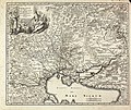


.pdf/page1-86px-thumbnail.pdf.jpg)
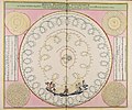
.jpg/120px-Napoli1727_(cropped).jpg)


